Browse Items (305 total)
Sort by:

The Keeper's Wife Exhibit
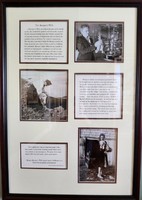
A Keeper's Wife not only took care of the family needs, she tended the gardens and livestock, cooked for the various working men and visitors, nursed the occasional survivors of shipwrecks and scrubbed the quarters clean at all times for surprise…
Candlestick Phone
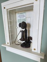
The candlestick telephone was common in use from the late 1890's to the 1940's. The telephone features a mouthpiece (transmitter) mounted at the top of the stand and a receiver (earphone) that was held to the ear by the user during a call. When the…
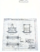
Funck-Heap Lamp
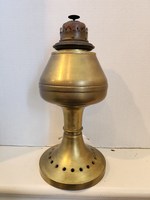
The Funck-Heap lamp, introduced in 1892, became the standard lamp used with every 4th order Fresnel Lens in America. A Lamp such as this one probably provided the light source for the Fresnel lens on display in the center of this room before it was…
Light Hearted ep 168 – Linda Warner, Beavertail, Rhode Island
On line podcast interview of BLMA board member Linda Warner by Jeremy D’Entremont.