Browse Items (305 total)
Sort by:
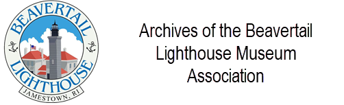
Horse Driven Fog Signal
Model of horse-driven fog signal used at Beavertail in 1851.
It was designed by David Daboll of New London CT. to operate his famous fog trumpet.
The horse, walking the endless treadmill, compressed air into a tank, which in turn modulated the…
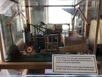
Horse Powered Treadmills (19th Century)
Horsepower treadmills during the 19th century were not uncommon. Many were used to power a variety of pumps, presses, saws, and tools on farms in remote areas where electricity or the gasoline engine was not available.
Hudson City Light Station Photograph
Hudson City Light Station photo was taken on May 11, 1936. The vent ball on top of its lantern room is now on display in this museum
Ida Lewis -Lighthouse Keeper
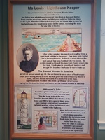
Wall display on life & exploits of Ida Lewis
Ida Lewis Lighthouse -Model
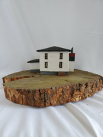
This lighthouse was built in 1854, standing at 13ft tall, and was later automated in 1927. It is located in Newport Harbor in Newport, RI. Today, the owner of the lighthouse is the Ida Lewis Yacht Club. In 1924, the lighthouse was renamed after Ida…
Keeper Carl Chellis
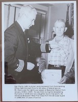
Carl Chellis (right) is shown receiving an award from Commanding Officer NAS Quonset Point for 40 years of federal service.
Mr. Chellis was the lighthouse keeper at Beavertail Station from January 1938 to 1945. He was there during the devastating…
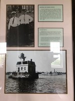
Keeper Edward A. Donahue
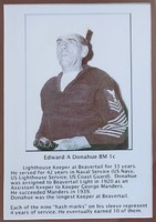
Lighthouse Keeper at Beavertail for 33 years. He served for 42 years in Naval Service (US Navy, Us Lighthouse Service, US Coast Guard). Donahue was assigned to Beavertail Light in 1920 as an Assitant Keeper to Keeper George Manders.He succeeded…
Keeper House
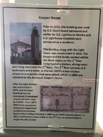
Prior to 1972, this building was used by U.S. Coast Guard personnel and earlier by U.S. Lighthouse Service and U.S. Lighthouse Establishment personnel as a residence.
This building along with the Light Tower was constructed in 1856. The Keeper and…
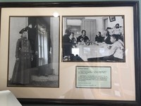
Keepers and their Families & Sabin Point Lighthouse
America's lighthouses are more than just buildings. For more than two centuries the usefulness of a lighthouse has depended on the dedication of its keeper to tend the beacon faithfully. Family members, too. shared the keeper's duties and provided…
Lady Lighthouse Keepers at Beavertail
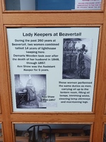
During the past 260 years at Beavertail, two women combined tallied 14 years of lighthouse keeping here.
Demaris Weeden took over after the death of her husband in 1848. Ann Shaw was the Assistant Keeper for 5 years
These women performed the same…
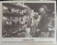
Lens and Lamps
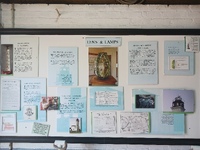
Wall exhibit featuring the lenses and lamps installed at the Beavertail Lighthouse over time.
Light Hearted ep 168 – Linda Warner, Beavertail, Rhode Island
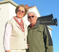
On line podcast interview of BLMA board member Linda Warner by Jeremy D’Entremont.
Lighthouse Fuels
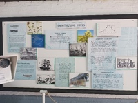
Wall exhibit describing the various lighthouse fuels over time.
Lighthouse Keeper Henry Whaley Photo
Henry Whaley and his father, Joseph, kept this light from 1862 to 1908. Joseph's sister married Henry Cark, the first keeper of Block Island's Southeast light.
Joseph Whaley Jr was born at Point Judith Lighthouse in 1893 and lived there until he was…
Lighthouse Locations in Rhode Island
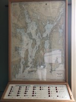
An interactive display showing the locations of Rhode Island Lighthouses. When a button is pressed a corresponding light on the map will indicate the location of the selected lighthouse.
The current display was built by Varajoun Karentz to replace…
Lighthouse Models Display - Retired
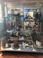
Models of lighthousesbuilt by Joe Bouchard.This display case has been retired
Lighthouse Models in Display Case
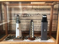
These models represent the Lighthouse structures that have stood at Beavertail over the years
The model of the first lighthouse was constructed by Varoujan Karentz in 2020.
The maker of the second Lighthouse model is unknown.
The third model,…